Detailed, practical guides to help you plan a Fiordland visit. Always confirm prices, schedules, access, and conditions with the linked official source before relying on them.
Start with the decision that shapes the day.
These guides are built around practical choices: drive or tour, book or stay flexible, walk short or go deep.
Milford timing
Fuel, weather, stops, cruise time, and daylight all matter more than the map distance suggests.
TracksPrepare properly
Fiordland tracks can feel benign one hour and exposed the next. Pack for the change.
BudgetSpend where it counts
Self-catering, free walks, and smart booking choices leave room for the experiences that matter.
PhotosFollow weather and light
Rain, mist, dawn, and low cloud are often the difference between record shots and memory shots.
Milford Sound Planning Guide
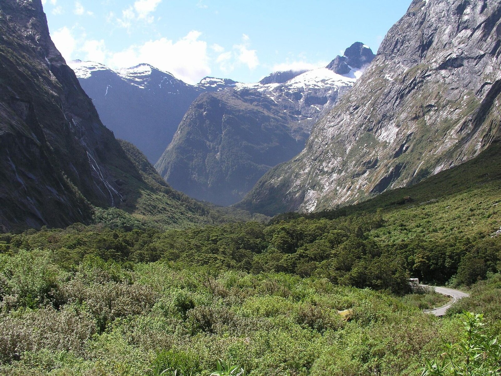
A Milford Sound/Piopiotahi day involves a remote mountain road, changeable weather, an activity check-in time, and limited services. Use this guide for the planning sequence, then confirm road status, DOC access notices, weather, and operator details immediately before travelling.
Should You Self-Drive or Take a Tour?
This is the biggest decision you'll make, and the answer depends on your situation:
Self-drive
- Stop at open viewpoints and short walks at your own pace after checking DOC access alerts
- Lets you compare current cruise, vehicle, and fuel costs separately
- Flexibility to leave early or stay late
- Carry food or reserve ahead at Pio Pio Restaurant; Milford has no grocery store and services are limited
- Requires confidence driving mountain roads
Guided coach-and-cruise tour
- Commentary about the scenery and history
- No driving stress on winding mountain road
- Many products combine the coach and cruise in one booking; check exactly what is included
- Good for solo travelers (no car rental needed)
- Less flexibility — fixed schedule and stops
The Milford Road: What to Expect
The Milford Road is about 118-120km each way from Te Anau. Allow at least 2-2.5 hours one way in good conditions, and longer for scenic stops, traffic, or changing weather. Check the official road status before leaving and do not plan around a best-case driving time.
Clearer conditions can reveal wider alpine views, while rain can create temporary waterfalls and mist. Heavy rain, snow, ice, wind, avalanche work, crashes, and road works can also affect travel, so scenery never overrides the live road status or current instructions.
One thing to know early — this is not a "stop every 10 minutes for a coffee" kind of drive. There are no grocery shops along the route and services are very limited until Milford Sound, where Pio Pio Restaurant may be available. Carry food and water, and check or reserve restaurant availability rather than relying on a walk-in meal. The road can also get very busy in summer, especially around popular stops.
Planning Tip
If you're driving from Queenstown — something a lot of people do since that's where the airport is — stop over in Te Anau for a night to take the pressure off. If you can't do that, then drive to Milford and give yourself plenty of time. On the way back, do your sightseeing. It makes for a more pleasant, less rushed trip.
Key stops along the way (in order):
- Eglinton Valley (around 52km): Roadside viewpoints and interpretation describe the broad glacial valley. Stop only in designated safe areas.
- Mirror Lakes (around 56km): DOC describes a roughly 10-minute accessible boardwalk beside small tarns that can reflect the Earl Mountains when calm.
- Knobs Flat (around 62km): A useful road stop with interpretation and toilets. DOC's Milford Highway guide also identifies toilets at The Divide and Milford Sound/Piopiotahi; facilities can close, so use them when available.
- Lake Gunn Nature Walk (from Cascade Creek, around 76km): An easy forest loop that DOC lists at about 45 minutes. Check track notices before relying on access.
- The Divide (85km): Start of the Routeburn Track and Key Summit. Lowest east-west pass in the Southern Alps.
- Key Summit (from The Divide): A roughly 3-hour-return alpine day walk when DOC confirms the track and conditions are suitable.
- Lake Marian: A more demanding track that is sometimes closed by storm damage. Only plan it when DOC confirms the bridge, track, and access are open.
- Monkey Creek (95km): Scenic roadside stop with alpine views. Carry your own drinking water rather than relying on untreated roadside streams.
- Homer Tunnel (around 101km): A roughly 1.2 km single-lane tunnel. Obey current signals, signs, stopping restrictions, and road-team instructions; do not stop in an unsafe place to photograph kea.
- The Chasm (around 109km): A short river-and-rock stop only when DOC confirms the car park and walk are open. Flood-recovery work can affect access.
- Milford Sound/Piopiotahi (around 120km): Allow time for parking, walking to the terminal, and the operator's current check-in deadline.
Toilets (Worth Knowing)
DOC's Milford Highway guide identifies toilets at Knobs Flat, The Divide, and Milford Sound/Piopiotahi. Facilities are limited and can close for maintenance, so check current notices and do not pass an available toilet assuming the next one will be open.
Which Cruise Should You Book?
There are several operators, and the experience varies more than you'd expect:
- Day cruises: Compare trip duration, vessel size, commentary, terminal check-in time, and any transport included.
- Small-boat or nature-focused trips: Check the current itinerary rather than assuming a particular route, wildlife sighting, or stop.
- Overnight cruises: Check operating dates, cabin type, meals, activities, and cancellation terms directly with the operator.
The Rainy Day Secret
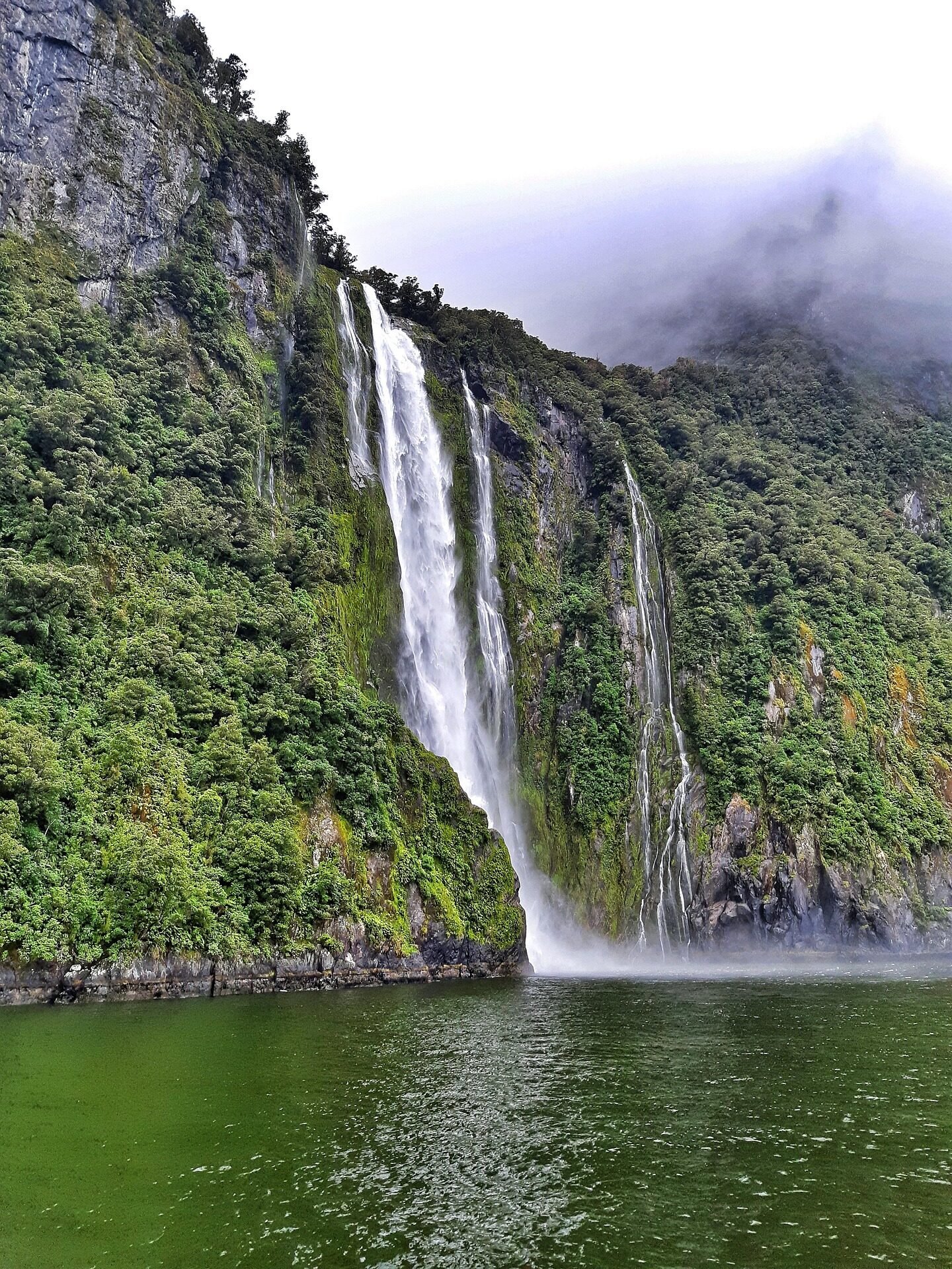
Rain can create temporary waterfalls across the fiord's cliffs, while clearer weather can improve mountain views. Heavy rain can also affect visibility, activities, and the Milford Road, so treat the forecast as a safety and planning input rather than a guarantee of a particular experience.
Ice & Frost on the Milford Road
Cold, wet conditions can create frost or ice, especially on bridges, shaded sections, and the Homer Tunnel approaches. Check the official SH94 notice, obey chain requirements and roadside instructions, and drive to the conditions even when the road is open.
Practical Checklist
- Fill your fuel tank in Te Anau; there are no public fuel stations between Te Anau and Milford Sound
- Pack sufficient food and water; any Milford food service has limited hours and capacity
- Bring insect repellent and cover exposed skin
- Download offline information because mobile coverage is limited and intermittent
- Check road conditions: 0800 444 449
- Bring warm layers even in summer (boat deck is cold)
- Camera with waterproof protection
Fiordland feels bigger when you stop trying to rush through it.
Good plans leave room for mist, road works, weather calls, track conditions, and those small scenic stops that become the memory.
Kepler Track: First-Timer's Preparation Guide
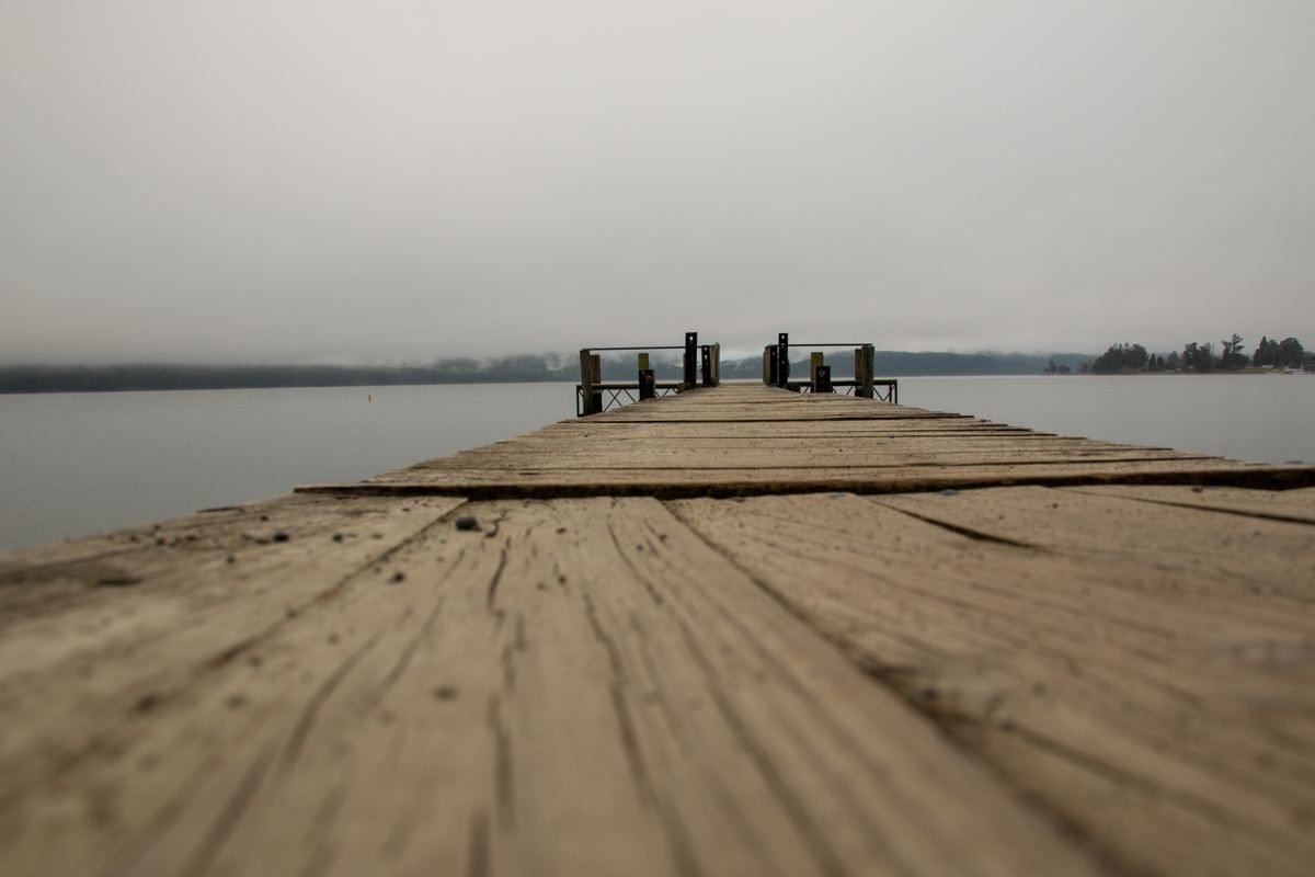
The Kepler Track is one of New Zealand's Great Walks and the most accessible from Te Anau — the trailhead is just 5km from town. Here's how to prepare, what to expect each day, and mistakes to avoid. For the wider Great Walk comparison and DOC alerts, start with the Great Walks guide.
This is the standard main-season itinerary, not a statement that every hut is open. A closure at Iris Burn or another section can make the route unusable. Confirm every hut booking and current DOC alert before starting; do not substitute an unapproved overnight plan.
Day-by-Day Breakdown
Day 1: Kepler Track car park to Luxmore Hut (13.8km, 5-6 hours)
Starts along the lake shore through beech forest. The first 5.6km to Brod Bay takes about 1 hour 30 minutes and is a popular day walk. From Brod Bay, allow another 3 hours 30 minutes to 4 hours 30 minutes for the steep climb to Luxmore Hut (1,085m). The hut has spectacular views over Lake Te Anau. Side trip: Luxmore Cave (about 20 minutes return) — bring a headlamp.
Day 2: Luxmore Hut to Iris Burn Hut (14.6km, 5-6 hours)
This standard stage traverses an exposed alpine ridge before descending through forest to Iris Burn Hut. The ridge is highly exposed to weather, and the track shelter is for emergencies rather than an alternative overnight stop. Only follow this stage when DOC confirms the route and Iris Burn Hut are open and you hold the required booking.
Day 3: Iris Burn Hut to Moturau Hut (16.2km, 5-6 hours)
This standard stage follows forest and wetland country toward Lake Manapouri and Moturau Hut. Continue only when the full route and both huts are open, and treat the lake as cold, changeable water rather than assuming swimming conditions are safe.
Day 4: Moturau Hut to Rainbow Reach (6km, 1 hour 30 minutes-2 hours)
Easy walking across wetland and along the Waiau River terrace ends at Rainbow Reach, where pre-arranged shuttle transport may be available in season. To complete the loop on foot, continue another 9.5km (about 2 hours 30 minutes-3 hours 30 minutes) to the Kepler Track car park.
What to Bring
During the Great Walk season, DOC lists bunks with mattresses, heating, toilets, basic cooking facilities, solar lighting, and cold running water at the main huts. Facilities are reduced outside that season. In every season, carry what DOC's current equipment list requires, including:
- Sleeping bag (huts are heated but can be cool)
- Cooking and eating utensils. In the Great Walk season huts have basic gas cooking facilities; outside the season carry your own stove and fuel.
- Enough food for the booked itinerary plus an appropriate emergency margin
- Rain gear (waterproof jacket + pants)
- Warm layers (alpine section can be near freezing even in summer)
- Sturdy hiking boots (broken in!)
- Headlamp, first aid kit, sunscreen, insect repellent
Budget Note: Off-Season Walking
Outside the main Great Walk season, Kepler hut fees are usually lower and facilities are reduced, but conditions are more serious and bookings or rules can change by track and season. Check current DOC prices, booking rules, and alerts on the Great Walks page before treating this as a budget option.
Planning a Lower-Cost Te Anau Visit
Accommodation, food, fuel, tours, and DOC fees change, so a fixed daily budget quickly becomes misleading. Build a budget from current quotes for your dates, then add a contingency for weather changes or altered travel plans.
Accommodation
- Compare the total stay: Check holiday parks, hostels, motels, and self-contained rooms for your exact dates, including cancellation terms and booking fees.
- Use kitchens where practical: A shared or in-room kitchen can reduce food costs, but confirm the facilities before booking.
- Check DOC directly: Campsite and hut fees, eligibility, facilities, and booking rules vary by place and season.
Food
- Plan some supermarket meals and carry food for remote day trips.
- Check current menus and opening hours before relying on a particular cafe or takeaway.
- Milford Sound has limited food service and no grocery store, so take what you need from Te Anau.
Free and low-cost activities
Completely free activities:
- Punanga Manu o Te Anau/Te Anau Bird Sanctuary during daylight hours
- Lakefront walks and beaches
- DOC Visitor Centre displays when the centre is open; check its current location and hours
- Kepler Track day walks (Brod Bay return: about 3 hours)
- Mirror Lakes (on the Milford Road)
- The Chasm when the track is open; check current DOC alerts
- Sunrise/sunset photography at the lakefront
- Southern-sky stargazing; aurora may be visible only when solar activity, cloud, moonlight, and local viewing conditions align
Before paying for an activity:
- Compare the operator's live price, inclusions, departure point, and cancellation policy.
- Do not assume self-driving is cheaper until you include vehicle hire, fuel, parking, and every traveler's cruise ticket.
- Check current DOC rules before treating off-season Great Walk travel as a cheaper alternative; facilities are reduced and alpine risks are greater.
Build your own current budget
Use live figures for your dates
- Accommodation quote for the whole booking
- Food allowance per person per day
- Current activity and DOC booking fees
- Vehicle, coach, fuel, parking, and transfer costs
- A contingency for weather-related changes
Enter those figures in the site's Trip Cost Estimator; it now totals your inputs instead of presenting old prices as current.
Photography Locations in Te Anau & Fiordland
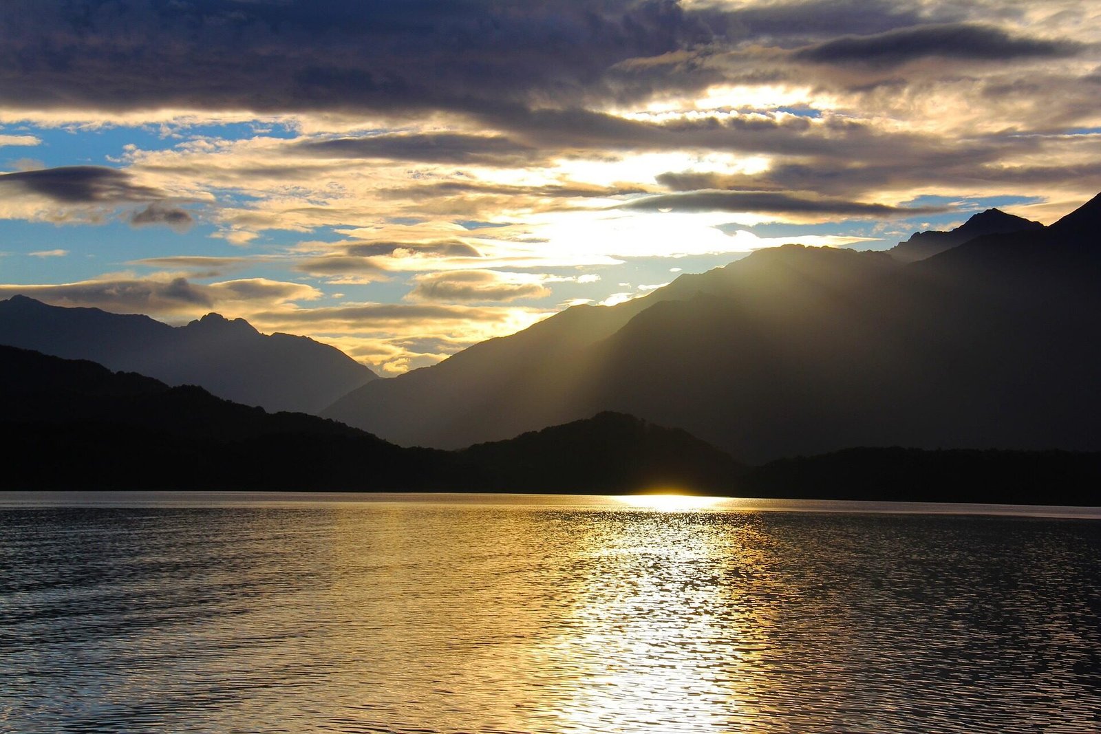
Light, cloud, wind, access, and safety conditions change quickly. These are useful location ideas, not promises about reflections, wildlife, visibility, or a single best time.
1. Te Anau Lakefront
Conditions: Dawn and dusk can bring low-angle light, while calm water may produce reflections. Use a safe public lakefront position and check the day's sunrise, sunset, cloud, and wind rather than relying on a fixed time.
2. Mirror Lakes
Conditions: The small tarns can reflect the Earl Mountains when calm. The accessible boardwalk is about 56 km from Te Anau; check SH94 and DOC access notices, and accept that wind or weather may remove the reflection at any time.
3. Milford Sound — Rainy Days
Conditions: Rain can produce temporary waterfalls and misty scenes; clearer weather can reveal more of the surrounding peaks. Protect camera gear and check the Milford Road and weather before travelling.
4. Key Summit
Conditions: This is an alpine walk of roughly 3 hours return from The Divide, not a roadside photo stop. Visibility can disappear quickly; only go when DOC confirms access and your group has suitable weather, daylight, footwear, clothing, and ability.
5. Kea near the Milford Road
Safety: Kea may be present near the Milford Road. Photograph them only from open, designated parking outside no-stopping and avalanche-control areas; obey signs and road-team instructions, keep clear of traffic, secure loose belongings, and never feed wildlife.
Photography Tips for Fiordland
- Protect your gear: Rain is frequent. Use a waterproof camera bag and lens cloths.
- Spare batteries: Cold weather drains batteries fast. Keep spares warm in your pocket.
- Polarising filter: Optional; it can reduce glare or reflections, but that may not suit every composition.
- Tripod: Useful for low-light landscapes. Follow each operator's photography rules; photography is not permitted in the glowworm grotto.
- Lens choice: Wide, normal, and telephoto lenses produce different views; take what you can carry safely.
Month-by-Month: What to Expect in Te Anau
January & February (Peak Summer)
Conditions: Long daylight and warmer spells, but Fiordland rain and rapid weather changes remain possible.
Planning: This is a high-demand period. Reserve important accommodation and activities, then check live track alerts and forecasts; summer does not guarantee every track or road is open.
Budget tip: Compare live prices and cancellation terms, especially around the holiday period.
March & April (Autumn)
Conditions: Shorter, cooler days arrive through autumn, with variable rain and mountain weather.
Planning: Demand can ease after summer, but Easter and events can still be busy. Check each Great Walk's season dates and current alerts.
Budget tip: Compare current shoulder-season availability instead of assuming a fixed discount.
May & June (Early Winter)
Conditions: Colder temperatures, shorter daylight, frost, and alpine snow or ice become more likely.
Planning: Some operators reduce schedules. Use designated cycle routes such as the Lake2Lake Trail; mountain biking is not permitted on the Kepler Track.
Budget tip: Check current opening days, tour schedules, and accommodation prices before relying on winter savings.
July & August (Mid-Winter)
Conditions: Cold mornings, frost, short daylight, and snow or ice can affect roads and alpine travel.
Planning: Check the Milford Road immediately before departure and treat Great Walks as winter alpine trips requiring appropriate skills and equipment.
Budget tip: Lower demand does not guarantee every service operates or that every price is lower; check live details.
September & October (Spring)
Conditions: Changeable spring weather can bring rain, wind, cold snaps, snow, and lengthening daylight.
Planning: Snow and avalanche hazards can remain on alpine routes. Check the exact DOC season dates and alerts for each track.
Budget tip: Compare live prices and operating dates before choosing spring for value.
November & December (Early Summer)
Conditions: Daylight increases, but rain, wind, and rapid temperature changes remain normal Fiordland possibilities.
Planning: Demand builds toward the summer holidays. Great Walk season and event dates vary, so use the current DOC and organiser information.
Budget tip: Compare live November and December prices rather than assuming summer conditions or shoulder-season rates.
Found this guide helpful? Buy us a coffee to help keep the site running.